

Traverse: Outdoor App Marketing for a 3D Mountain Map
A 3D terrain and slope-angle map app for Kosovo and Albania, with a refreshed brand, bilingual launch and social creative, store graphics and listing copy, and a search plan for its website.
- Client
- Outdoor app · terrain, trips, safety
- Live site
- traverse-3d.com ↗
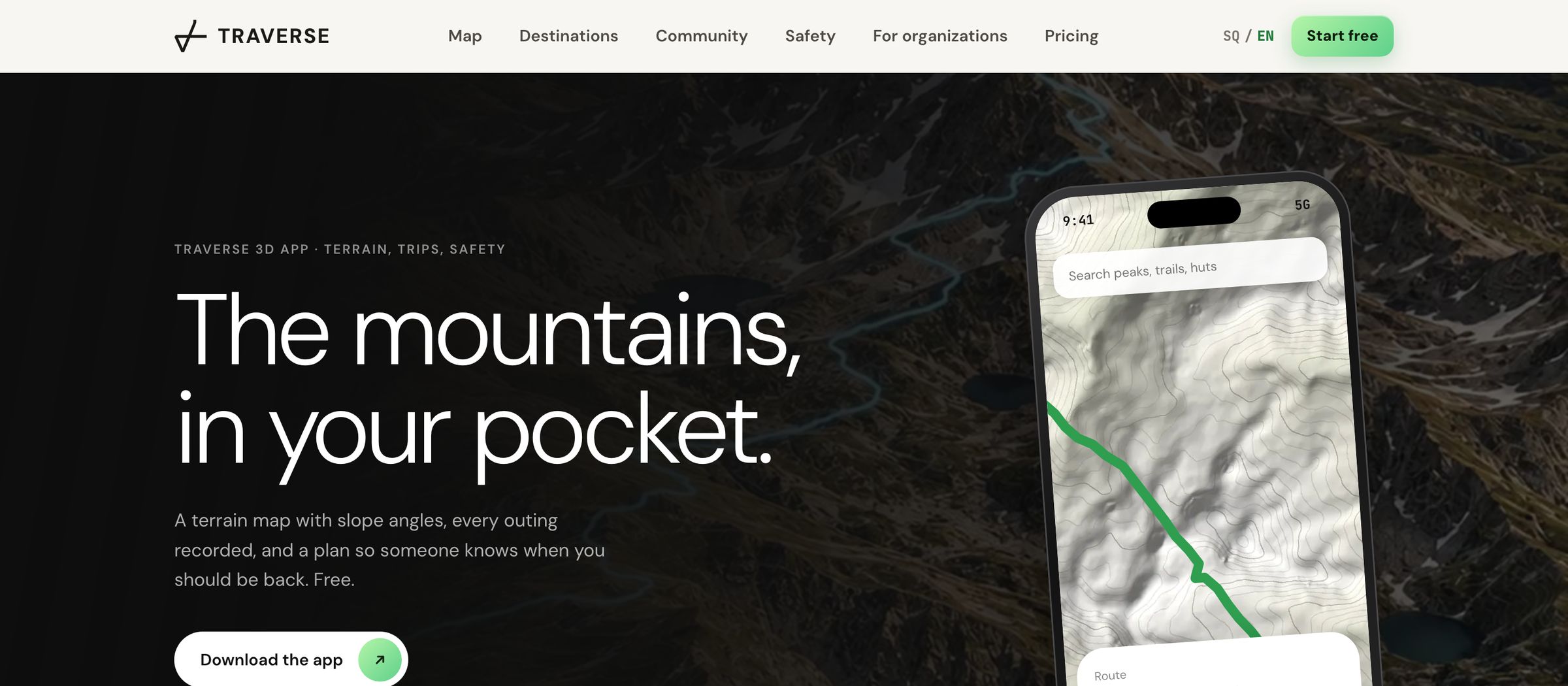
Traverse is an outdoor app for hikers, ski tourers and climbers in Kosovo and Albania, free to use with an optional Pro plan. It has 3D terrain, a slope-angle layer and trip plans that alert an emergency contact when someone does not check in. NextAds handled the outdoor app marketing around it: we refreshed the Traverse brand and made its launch and social creative, its store graphics and listing copy, and the search plan behind traverse-3d.com.
Who Traverse is for, and what they search
Traverse is for hikers, ski tourers, climbers, trail runners and mountain bikers in Kosovo and Albania and their clubs, including Kosovars who live abroad and come home in summer and visitors on the Peaks of the Balkans. Before they install a map app, they want to know how steep the ground gets, whether the map works without signal, who will know if they do not come back, and whether it covers their mountain.
We started the search plan on October 4, 2026, when no search-volume figures were available, so we set priorities by checking which sites already ranked for each search. A later Keyword Planner round added GPX viewers, 3D topo maps and trip planners. The searches fall into four groups:
Gjeravica, the Rugova gorge, Theth to Valbona, the Peaks of the Balkans, Korab and the Sharr mountains, often followed by “hike” or “map”.
FATMAP closed in October 2024, and people still search for a FATMAP alternative. Others look for alternatives to AllTrails, Komoot and Strava.
Slope angle maps, 3D hiking maps, GPX viewers and trip planners.
Apps that tell someone when a hiker is overdue.
Mountains are also searched under several spellings: Gjeravica is written Gjeravicë, Đeravica and Djeravica, and Sharr appears as Šar Planina and Malet e Sharrit.
Refreshing a brand from 2023
The starting point was Traverse’s 2023 brand deck: a mark drawn as one white stroke, a triangle with a crossbar and a hooked diagonal that reads like a route crossing a slope, and a wordmark often split into TRA in green and VERSE in violet, on charcoal. The brief called for a refresh of that brand. Genti Xharavina, a NextAds partner, led the work.
It began with an audit: how even the stroke is, how the top hook balances, whether the mark reads at 16 pixels, and whether green and violet read as outdoors or as gaming. Of three directions, Traverse chose the one named Traverse, Refined, which keeps the original mark, the charcoal and the green. Its rules:
The one-stroke route mark stays, cleaned up, and has to work in one color, at 16 pixels, embroidered on a jacket, on a map and next to a rescue organization’s logo.
TRAVERSE is set as one word, no longer split into two colors.
No mountain in a circle, no compass rose, no generic peak icon.
Albanian and English by default, on posters as well as in the app.
A job for every color
Ski tourers already read yellow, orange, red and purple as slope-angle bands, and a brand green beside them must never suggest that a slope is safe. So each color got one job:
| Color | Its job | The rule |
|---|---|---|
| Charcoal | Backgrounds, with light text | Dark first, in the app and the brand |
| Green | The brand and ordinary actions | Never implies that terrain is safe |
| Violet | Community, personal stories and the year in review | Kept away from warnings |
| Amber | Caution | Always with a warning triangle and words |
| Red | SOS and critical alerts | Used for nothing else |
| Slope bands | Slope steepness on the map: yellow from 27 to 30°, orange to 35°, red to 40°, purple to 45° and dark violet above 45° | Only on the slope layer and its legend |
The website is dark first and uses the brand green, with DM Sans for text and a monospace face for figures and coordinates.
Icons, map pins and brand pieces
The white mark over contour lines of the real Gjeravica massif, drawn from Copernicus elevation data and lit like the app’s 3D map. The same art backs the Android and Google Play icons.
The mark cut down for Android’s notification icon and the splash screen, and set in charcoal on green and in white over terrain for profile pictures.
Eight pins: hazard, hut, spring, photo, crag, paragliding launch, bike and ski resort. Each sits on an opaque carrier with a white and charcoal edge so busy terrain cannot swallow it, and the set mixes circles, squares and triangles as well as symbols. Only the hazard pin is amber.
A repeat pattern built from the mark, and mockups of a patch, a woven label and a zipper pull.
Launch creative in two languages
The launch set is 36 images, including five of the feed posts below. Their people and landscapes are AI-generated, art-directed to the brand rules and labeled with places such as Rugova, Gjeravica and Brezovica; they are not photographs of real trips. The set uses four layouts:
An Albanian headline, the English under it and a Free tag: Jashtë, bashkë (Outside, together), Gjej vijën tënde (Find your line), Gjej shoqërinë tënde (Find your people), Më shumë shteg (More trail), Shihe Kosovën ndryshe (See Kosovo differently), and Vendet tona. Kujdesi ynë (Our places. Our care.) for clean-up days.
The wordmark set very large in black on green, with a black-and-white action image cut through it: ski touring, hiking, mountain biking, climbing, trail running and rafting.
Full-bleed scenes with small corner labels in both languages naming the place, the sport and the conditions.
The mountain as an object: elevation layers lifted apart, contour lines floating over a ridge, the slope bands painted across a limestone face.
Social posts for launch
For Instagram we made nine 4:5 feed posts, a full-screen story and two profile pictures. The feed posts run in numbered series that also work as carousels:
A block of mountain shown as ice and as rough rock, and the same kind of terrain under raindrops.
Elevation layers, the slope layer, contour lines, a valley cross-section and Brezovica’s upper slopes.
Store graphics and listing copy
A store page is often where someone first meets an app, so the five screenshots work as a sequence, each with one headline over the part of the app it describes:
- 1
“See the mountain in 3D” over the 3D map with the slope layer.
- 2
“Know your route. Before you go.” over a route’s distance, climb and elevation profile.
- 3
“Your day. Recorded.” over trip recording, which works without mobile signal.
- 4
“Read the terrain” over the map styles, 3D relief and slope angles.
- 5
“Leave a plan. Keep in touch.” over the trip plan and the SOS button.
The App Store set is made at the 6.9-inch and 6.3-inch iPhone sizes. Google Play got the icon and a 1024 by 500 feature graphic built from real terrain.
The listing copy is written in English and Albanian: the name Traverse 3D, the App Store subtitle “3D terrain, trips, safety”, the short and full descriptions and the keywords. It keeps the app’s rules: other people’s reports are marked unverified until confirmed, and terrain ratings “describe the terrain, not today’s conditions”. On October 24, 2026 the Google Play listing was live under Maps & Navigation.
The search plan behind traverse-3d.com
We wrote the search plan for traverse-3d.com and made the site’s terrain images: a render of each destination from real elevation data, plus a version with the slope layer, each labeled as a rendered view. The site’s pages follow the plan. On October 24, 2026 its sitemap listed 734 pages, 402 in English and 332 in Albanian:
A Gjeravica terrain map that reads height and steepness under the cursor, a route profile with walking time by sport, and the trip-plan steps.
Gjeravica, Rugova, the Peaks of the Balkans, the Albanian Alps, the Sharr Mountains and Korab, each with routes, seasons, common questions and a slope render. Most also cover getting there and the place’s other names.
A hub of 18 routes on mapped OpenStreetMap trails with distance, climb, difficulty and season. Five have their own page with the route line, an elevation profile and how the numbers were worked out.
80 summits in Kosovo, 198 in Albania, 71 in North Macedonia, 9 in Greece, 3 in Montenegro and 2 in Serbia.
FATMAP, AllTrails, Komoot, Strava, onX Backcountry and Wikiloc alternatives, CalTopo against Gaia GPS, a four-way comparison and hiking apps for Albania and Kosovo.
A slope angle map, slope angle and aspect with the avalanche bulletin, ski touring, a hiking safety app, a 3D hiking map, planning a hike and a free 3D GPX viewer.
Download, help, organizations, pricing, refunds, privacy, terms and account deletion.
The Albanian version covers the home page, destinations, route guides, 307 peak pages, four comparison pages and most help pages, each linked to its English version.
Peak pages with figures of their own
Each peak page carries its own figures: a height from the Copernicus terrain model and, where OpenStreetMap has one, the OpenStreetMap height, plus coordinates, the share of ground steeper than 30° within 500 meters, two terrain profiles and the nearest higher summit. The 13 summits whose two heights differed by more than 100 meters were left out.
Structured data marks the app as a mobile application with a free offer and no star-rating markup, the peaks as mountains and the routes as tourist attractions.
Pages that say what the app does not do yet
A page that oversells a mountain map can send someone onto the wrong slope, so the copy follows the brand’s rules:
The slope layer is described as the shape of the ground, never as avalanche danger. The slope guide tells readers to read the official bulletin first, and the ski touring guide says plainly that Kosovo, Albania and Montenegro have no public avalanche bulletin.
The slope layer covers Kosovo, Albania and the Sharr range today. The aspect layer is on the website’s 3D map now and reaches the app in the next app update. The FATMAP page marks each feature Live, Partly, Next app update or Not available.
Peak data is labeled unverified, the route guides say the team has not walked the routes yet, and ski tours stay off the site until a mountain rescue organization has rated their terrain.
SOS shows only what has happened: prepared, sent or acknowledged. The site says no rescue organization is verified on Traverse yet, and tells readers to call 112.
Every comparison page gives the date it was checked and says Traverse is not affiliated with the other apps, and each page about an app that is still running says where that app is the stronger choice.
Outdoor app marketing: what we would do the same way next time
- 1
Audit the brand you have before drawing a new one, and keep what people already recognize.
- 2
Give each color one job, and keep warning colors for warnings.
- 3
Make the store screenshots a sequence of single headlines, each over the screen it describes.
- 4
Write the creative and the listing in every language your buyers use, from the first post.
- 5
Build pages for the places and problems people search, with figures they can check, and say plainly what the product does not do yet.
For gear and apparel brands, outdoor brand marketing explains how we plan ads, creative and product pages around the season. The services behind this project are graphic design and branding, ad creative and social media content. The Titro case study covers another app project, and the rest of our projects, including Wander Balkans in the same mountains, are on the work page.
If you have an app or an outdoor brand to launch, tell us about the product and who you want to reach through the contact page. A partner replies within one business day.
Questions about this project
What did NextAds do for Traverse?
The brand refresh, the launch and social creative, the store graphics and listing copy, the website’s terrain images and its search plan. The app, its maps and its safety features are Traverse’s own product.
Are the people in the Traverse posters real?
No. The people and landscapes in the campaign images are AI-generated and art-directed to the brand rules. The terrain images on the website are renders of real elevation data, and the pages label them as renders.
Why is the Traverse brand in two languages?
Its users in Kosovo and Albania speak Albanian, and visitors from abroad read English. The posters lead with Albanian, and most of the website has both versions.
Can hundreds of peak pages get a site into trouble with Google?
They can if the pages add nothing. Google’s spam policies call it scaled content abuse when many pages are generated mainly to manipulate rankings and offer little value to readers. Each Traverse peak page carries figures of its own, the 13 summits whose data disagreed were left out, and each peak page labels its data unverified. Whether and where a page ranks is up to Google.
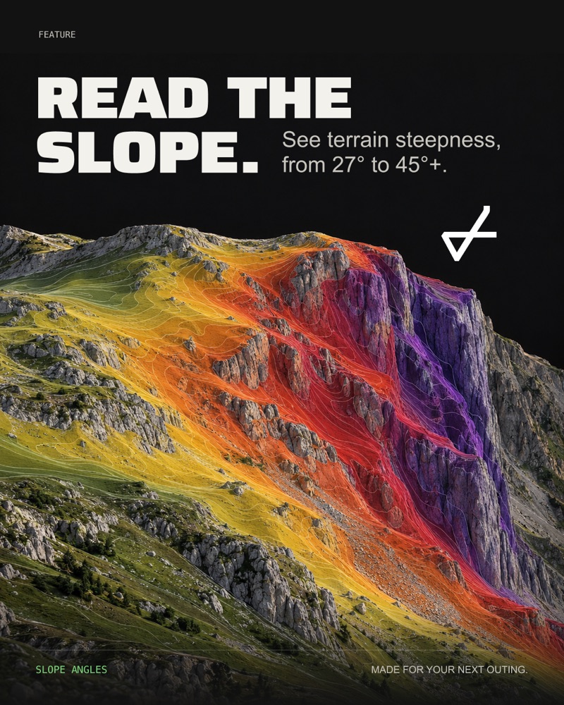
Read the slope
Terrain steepness from 27° to 45° and up, read before you go.
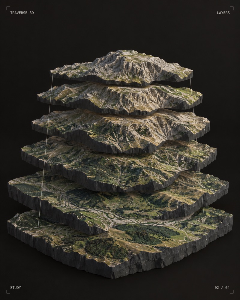
Terrain in layers
How the 3D map is built, shown as a study.
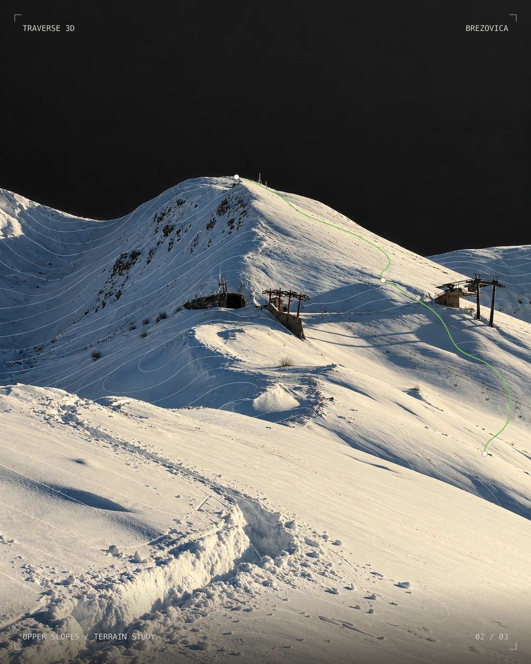
Upper slopes
A planned line drawn over the real contours.

The mark
The Traverse mark on woven and rubber patches.
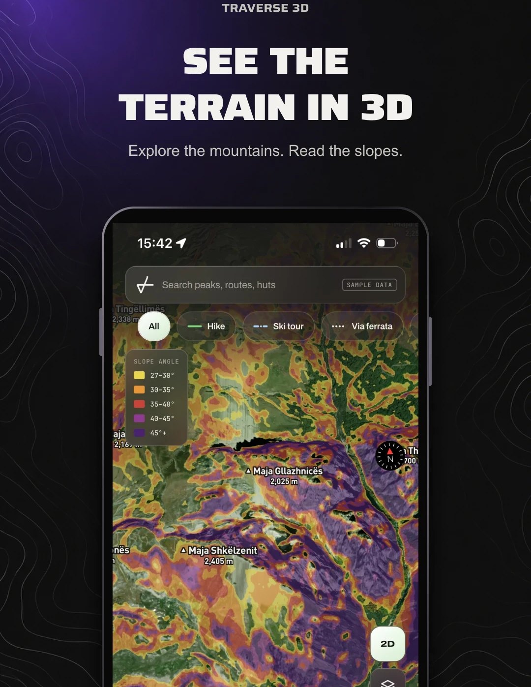
In the app
The 3D map with the slope-angle layer switched on.

Trail marker
The Traverse mark, painted the way routes are marked.

The map as an object
Terrain, cut and lit like a still life.
Other projects
 KBD Plumbing & HeatingDobbs Ferry, NY · plumbing & heatingRead the case study →
 The Sterling GroupInspections and appraisals · New JerseyRead the case study →
 Central Jersey Property MaintenanceCommercial property maintenance · Cranbury, NJRead the case study →
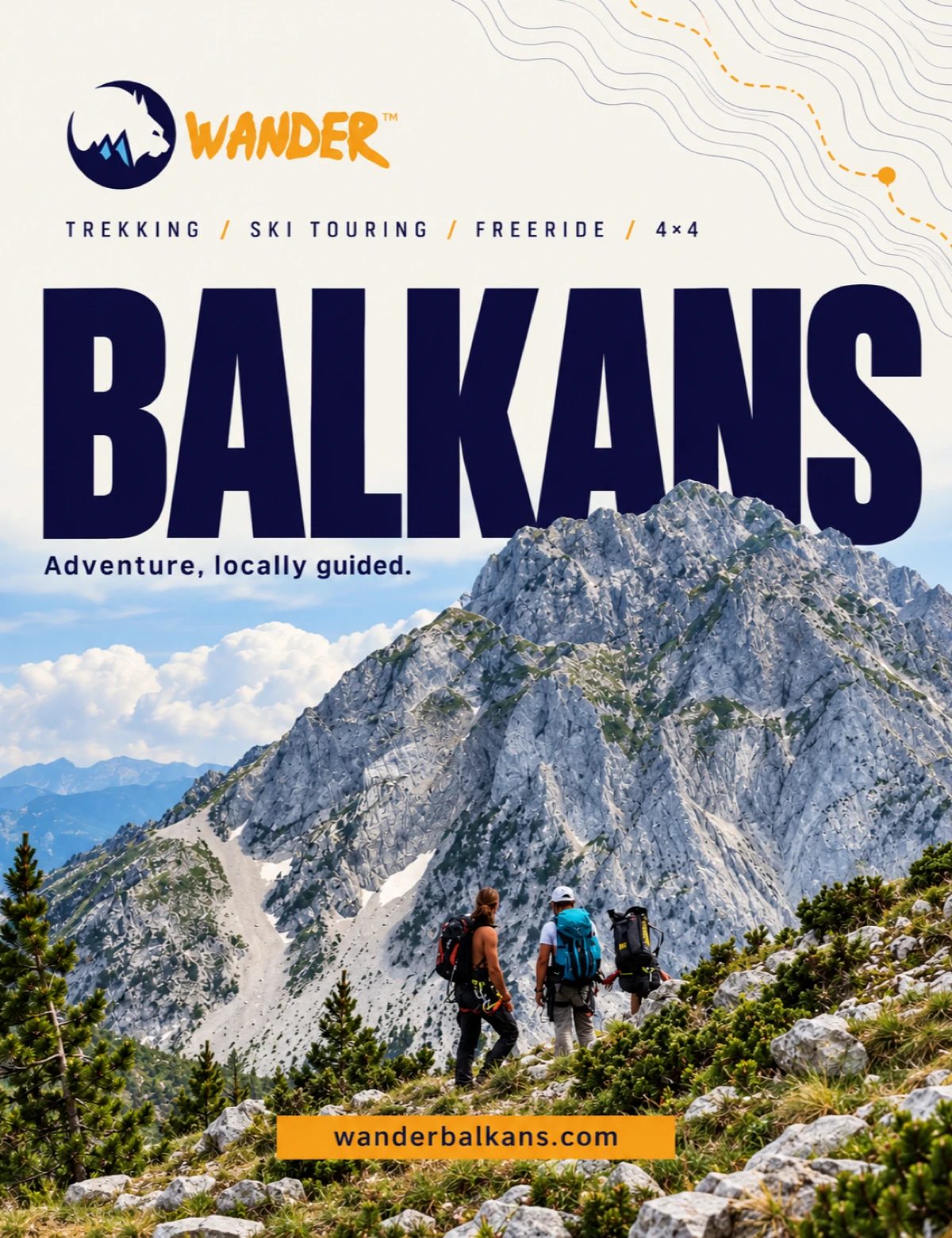 Wander BalkansAdventure tours · Peja, KosovoRead the case study →
 TitroAutomatic subtitles for videoRead the case study →
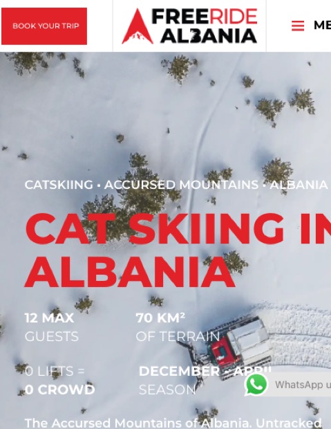 Freeride AlbaniaCat skiing · Accursed Mountains, AlbaniaRead the case study →
Tell us what you sell.
We reply within one business day, starting with a free review of your ads and the page they land on.
- You send the basics. What you sell, your site, and what it should do better.
- A partner reads it. Your ads and the pages they land on, from public information.
- You get a reply in one business day. What we would fix first, in plain English.